Going Places

For today's work, the first thing you need to do is find a map of the area you live in. You might need to involve a Team Lock Down Adult in this, particularly because you are going to draw on the map.
Most homes have a random kind of selection like my home

It doesn't matter if they are a tad old, in fact, that's good. If you really don't have ANYTHING like this in your house, ask your responsible adult to print of a map from Google Map. Which is not nearly as satisfying as unfolding and pouring over a real map, but it will do the trick.
On your map, find where your house is and draw it in. Draw or mark any other places of significance.
Now, draw on the map one of the walks you have done. Maybe you walk every day the same route, maybe you mix it up a little. If you have several walks, use different colours for the different walks. It does need to be accurate: not just a bit of a dotted line in the direction where you went, but exactly which streets you walked.

This is the Anzac Day walk we did and I already told you about. It was about 14 km and took us 4 hours, including our Anzac Biscuit stop at the top of Witches Hill.

This is the same walk, but a different map. Just wanted to give you an idea that different maps look slightly different.
Does your map have a compass rose? Which direction in your house is North? Ask an adult, use a compass or work it out: the place where the sun is around 12 pm is North.
Turn your map towards the North- can you see how this works?

This is another walk I did with Mackenzie the week before. We didn't plan to go that far, we were just exploring a walkway we found beside the Tannery (this map is so old that the Tannery is not on there, just the street) We kept exploring until we suddenly could see the sea and we thought we might as well keep walking. So we walked all the way to Sumner and back, which is about 18 km from my house.
It was fabulous!
It was fabulous!
Now choose three landmarks on your map. A landmark is a noticeable building or tree or any other mark which stands out. The Tannery is definitely a landmark for example.
Glue the maps into your journal. In the writing part, describe the three landmarks you have chosen.
Here is my example
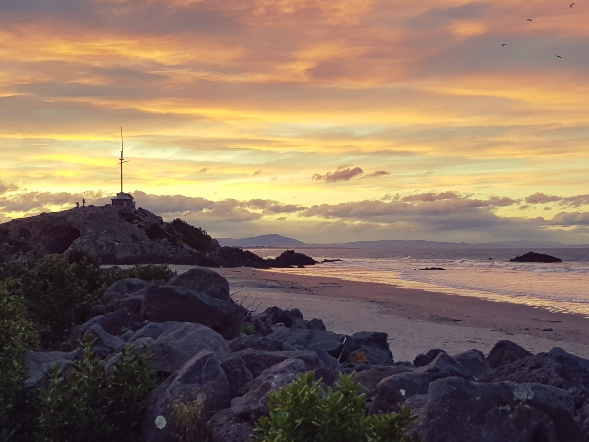
Sumner Rock
On the beach in Sumner is a huge rock. The first time I ever came there, David made me scramble all the way to the top. Once I was at the top, I saw that there is actually a pathway you can take, which is steep, but a lot easier than my scramble. Underneath the rock is a cave which is like a tunnel from one beach to the next. When the tide is in, the cave is full of water but at low tide, you can walk through the cave.
On warm summer evenings, getting an ice cream and sitting on one of the rocks beside Sumner Rock is one of the best things in life. It is such a good vibe place to be.
On warm summer evenings, getting an ice cream and sitting on one of the rocks beside Sumner Rock is one of the best things in life. It is such a good vibe place to be.
This is your journal, so write anything interesting or important for you or your family down. For example: this is the hill where Ophelia crashed from her scooter.
Have fun Class 4, maps are always full of dreams and promises and the taste of adventure. Learn to read them properly, it is a life skill you will never regret.


Comments
Post a Comment